Highly accurate geo-referenced 2D and 3D models, browser-based measurement tools also on the smartphone or tablet, target/actual comparisons over several epochs, integration of AI processes, GIS-based display and high-performance integration of the result data...
...we can provide you with all this and much more in our "Data Management" portfolio!
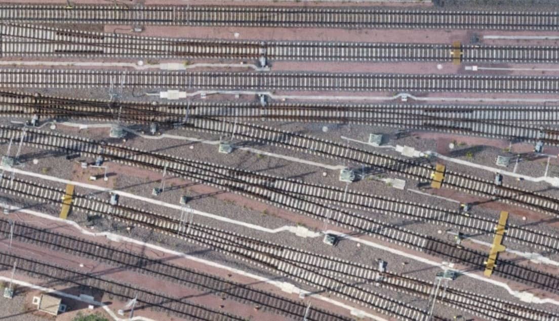
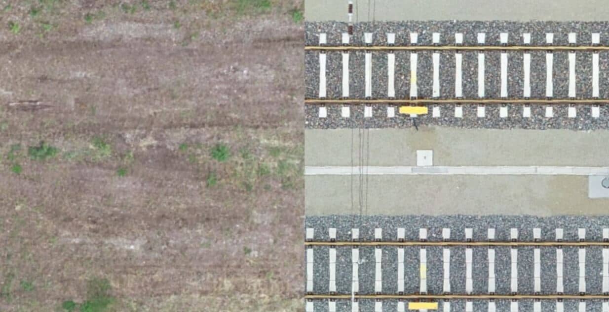
We generate highly accurate orthophotos in the desired georeferencing system. Get an up-to-date overview of your existing infrastructure. Avoid time-consuming site inspections and preservation of evidence in the danger zone!
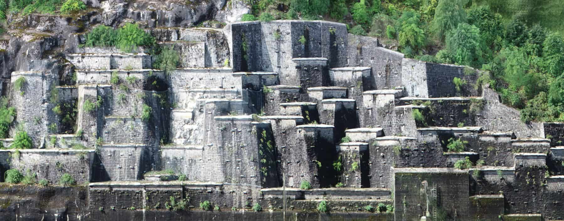
We can also provide you with highly accurate vertical orthophotos (e.g. for rock slopes). Here you can also access the razor-sharp original image data from the selected area with our inspection functions.
Browser-based measurement functions
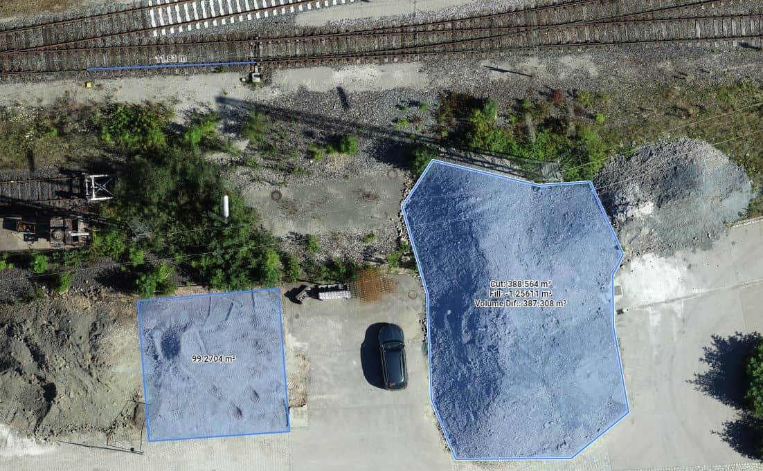
Measurements of distances, areas and volumes are quick & easy. Do not blindly trust measurements or invoices! - Simply check them yourself!
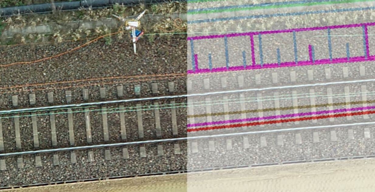
Compare flights of the same section over several time series & epochs! Simply use the Compare function in the Viewer. This gives you the opportunity to check and document the construction progress at any time. Be yourself always up to date and informative!
Has the construction been carried out according to the present planning? Display the corresponding plans here and check for yourself! The target/actual comparison has never been so easy!
3D visualization
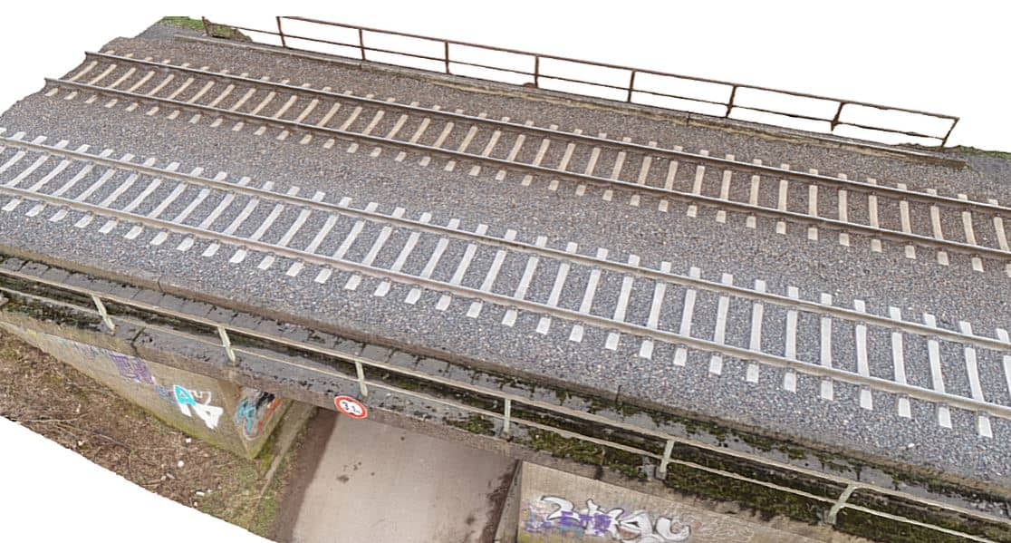
We create the corresponding 3D point cloud for you at the same time. Move in 3D space in your project and feel free to use these models as input data for further BIM planning!
We create the corresponding 3D point cloud for you at the same time. Move in 3D space in your project and feel free to use these models as input data for further BIM planning!
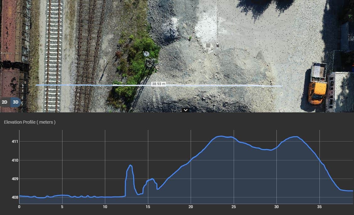
Detailed cross sections
Feel free to generate detailed cross sections or gradients at any point of your generated model. We are happy to support you here with the extensive usage possibilities of your data model!
Feel free to generate detailed cross sections or gradients at any point of your generated model. We are happy to support you here with the extensive usage possibilities of your data model!
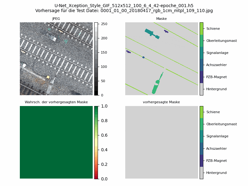
We also offer extensive experience in the area of automatic object recognition in image data via AI processes. Here we have both machine learning and deep learning approaches in use. No more time-consuming search for objects - let us search for you!
Do you want your valuable data to be available to as many users as possible?
No problem!
We can embed your models in map-based interfaces via a data service. This way you have all data available in one place and it is quickly and easily available for numerous users.